 Jeremy Norman’s
HistoryofInformation.com Exploring the History of Information and Media through Timelines
Jeremy Norman’s
The Waldsemüller map published in 1507 is the first map to include the name "America" and the first to depict the Americas as separate from Asia. This is a photograph of the only surviving copy of the map, which was purchased by the Library of Congress in 2001 for $10 million.
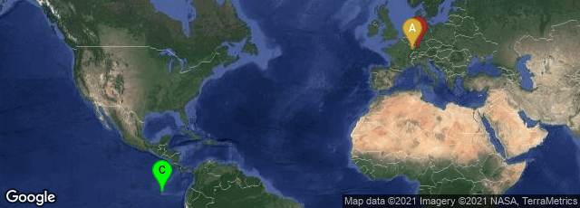
A: Saint-Dié-des-Vosges, Grand Est, France, B: Stuttgart-Mitte, Stuttgart, Baden-Württemberg, Germany, C: Ecuador
Universalis cosmographia secundum Ptholomaei traditionem et Americi Vespucii aliorumque lustrationes, or the Waldseemüller Map, a large wall map of the world drawn by German cartographer Martin Waldseemüller, was one of the first maps to chart latitude and longitude precisely, following the example of Ptolemy, and the first map to use the name "America".
Waldseemüller also created globe gores, printed maps designed to be cut out and pasted onto spheres to form globes of the Earth. At the time he drew his wall map, Waldseemüller was working as part of the group of scholars of the Vosgean Gymnasium at Saint-Dié-des-Vosges in Lorraine, which then belonged to the Holy Roman Empire. The maps were accompanied by the book Cosmographiae Introductio produced by the Vosgean Gymnasium.
"The Waldseemüller map depicts North and South America as two large continents. The main map shows the two continents slightly separated, while the small inset map in the top border shows them joined by an isthmus. The name "America" is placed on South America, this being the first map known to use this name. As explained in Cosmographiae Introductio, the name was bestowed in honor of Amerigo Vespucci.
"In depicting the Americas separate from Asia, the map shows a great ocean between the mountainous western coasts of the Americas and the eastern coast of Asia. The first historical records of Europeans to set eyes on this ocean, the Pacific, are recorded as Vasco Núñez de Balboa in 1513 or, Ponce de León in 1512 or 1513. Those dates are five to six years after Waldseemüller made his map. In addition, the map predicts the width of South America at certain latitudes to within 70 miles.
"Apparently among most map-makers until that time, it was still erroneously believed that the lands discovered by Christopher Columbus, Vespucci, and others formed part of the Indies of Asia. Thus some believe that it is impossible that Waldseemüller could have known about the Pacific, which is depicted on his map. The historian Peter Whitfield has theorised that Waldseemüller incorporated the ocean into his map because Vespucci's accounts of the Americas, with their so-called "savage" peoples, could not be reconciled with contemporary knowledge of India, China, and the islands of Indies. Thus, Waldseemüller reasoned, the newly discovered lands could not be part of Asia, but must be separate from it, a leap of intuition that was later proved uncannily precise.
"Most importantly, Mundus Novus, a book attributed to Vespucci (who had himself explored the extensive eastern coast of South America) was widely published throughout Europe after 1504, including by Waldseemüller's group in 1507. It had first introduced to Europeans the idea that this was a new continent and not Asia. It is theorised that this lead to Waldseemüller's separating America from Asia, depicting the Pacific Ocean, and the use of the first name of Vespucci on his map.
"The wall map consists of twelve sections printed from wood engravings measuring 18 x 24.5 inches (46 x 62 cm). Each section is one of four horizontally and three vertically, when assembled. The map uses a modified Ptolemaic conformal projection with curved meridians to depict the entire surface of the Earth."
"Of the one thousand copies of the wall map printed, only one complete copy is known. It was originally owned by Johannes Schöner (1477–1547), a Nuremberg astronomer, geographer, and cartographer. Its existence was unknown for a long time until its rediscovery in 1901 in the library of Prince Johannes zu Waldburg-Wolfegg in Wolfegg Castle in Württemberg, Germany by the Jesuit historian Joseph Fischer. It remained there until 2001 when the United States Library of Congress purchased it from Waldburg-Wolfegg-Waldsee for ten million dollars. Chancellor Angela Merkel of the Federal Republic of Germany symbolically turned over the Waldseemüller map on April 30, 2007, within the context of a formal ceremony at the Library of Congress, in Washington, DC. In her remarks, the chancellor stressed that the U.S. contributions to the development of Germany in the postwar period tipped the scales in the decision to turn over the Waldseemüller map to the Library of Congress as a sign of transatlantic affinity and as an indication of the numerous German roots to the United States. Since 2007 it has been permanently displayed in the Library of Congress, within a display case filled with argon. Prior to display, the entire map was the subject of a scientific analysis project using hyperspectral imaging with an advanced LED camera and illumination system to address preservation storage and display issues.
"Four copies of the globe gores are known still to exist. The first to be rediscovered was found in 1871 and is now in the James Ford Bell Library of the University of Minnesota. Another copy was found inside a Ptolemy atlas and is in the Bavarian State Library in Munich. A third copy was discovered in 1992 bound into an edition of Aristotle in the Stadtbücherei Offenburg, a public library in Germany. A fourth copy came to light in 2003 when its European owner read a newspaper article about the Waldseemüller map. It was sold at auction to Charles Frodsham & Co. for $1,002,267, a world record price for a single sheet map There has been some suggestion that a sheet of the map is from a second edition produced about 1515. Its preservation seems to be due to the several sheets being bound into a single cover by Schöner" (Wikipedia article on Waldseemüller Map, accessed 11-10-2009).
