
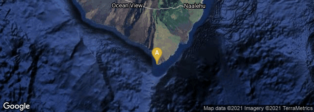
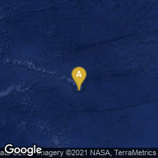
The first crude image taken by the satellite Explorer 6 shows a sunlit area of the Central Pacific Ocean and its cloud cover.
The first photograph of the earth from an orbiting satellite was taken by the U.S. Explorer 6 on August 14, 1959. The crude image shows a sun-lit area of the Central Pacific ocean and its cloud cover. The picture was made when the satellite was about 17,000 miles above the surface of the earth on August 14, 1959. At the time, the satellite was crossing Mexico. The signals were received at the tracking station at South Point, Hawaii (also known as Ka Lae).
(This entry was last revised on 11-08-2014.)
